In this week’s airspace case study we take a look at the class c airspace surrounding Daytona Beach airport in Florida.
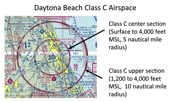
First let’s recap the characteristics of class c airspace. Class c is shown on aeronautical charts using magenta boundary lines and altitude numbers. It is made up of two separate airspace sections. The first inner section extends from the surface (SFC) up to 4,000 feet above airport elevation, and has a boundary radius of 5 nautical miles from the airport.
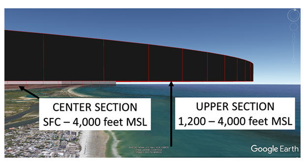
The next section surrounds the inner section with a floor at 1,200 feet above the airport, and has an upper limit of 4,000 feet. This layer extends from the inner section out to 10 nautical miles from the airport.

Remember that aeronautical charts display airspace vertical limits in altitude (height above mean sea level). To determine airspace altitudes in MSL, the airport elevation is rounded to the nearest 100 feet, and then AGL heights are added.
Daytona Beach airport is very close to the coast and has an elevation of 34 feet. This is rounded down to 0 feet MSL (sea level) which means that any heights measured above the airport in AGL are the same as altitude above MSL.

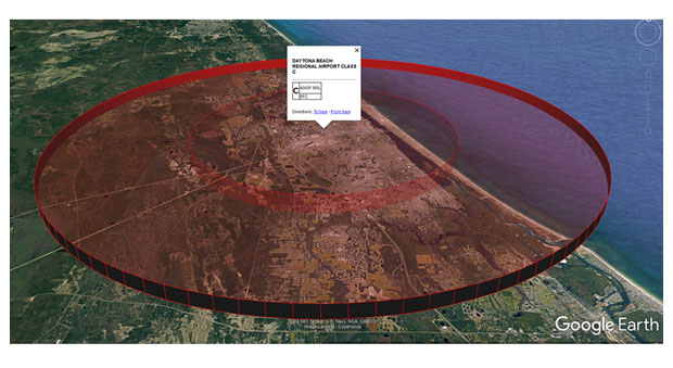
This image shows the Daytona Beach Class C airspace in 3D using Google Earth.

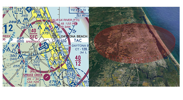
Because the outer section of Class C airspace begins at 1,200 feet well above normal drone operations, it is only the inner section of airspace that is likely to affect you as a drone pilot.

If you think your airspace knowledge could be improved check out our Part 107 Knowledge Proficiency Test preparation course at www.dronetrust.com
