In this airspace case study, we are going to look at class E airspace.

Class E airspace is quite complex. Generally, the whole of the US is covered in class E airspace with a floor that comes down to 1,200 feet above ground level (AGL). There are also areas where the floor of class E airspace comes down even lower. Palacios is a good example of this.

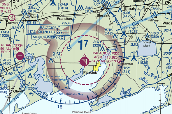
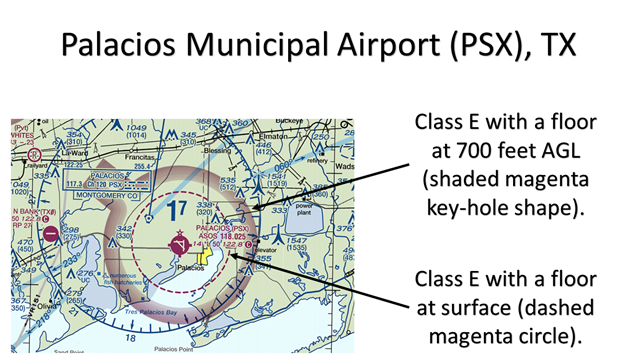
As you can see on the sectional chart above, there are two separate sections of class E airspace with a floor lower than the standard 1,200 feet AGL. The first is the shaded magenta (keyhole shaped) section with a floor down to 700 feet AGL. The second inner section, surrounded by the dashed magenta circle, has a floor down to the surface.
Because the inner section has a floor down to the surface, and is controlled airspace (class E), you must have authorization to fly your UAS here.

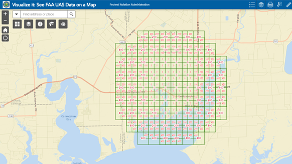
As you can see in the image above (taken from the FAA’s Facility Map) Palacio’s airport is in the facility database.
https://faa.maps.arcgis.com/apps/webappviewer/index.html?id=9c2e4406710048e19806ebf6a06754ad
The airspace grid gives an indication of the maximum heights (in feet AGL) that may be authorized. Note you must still obtain authorization before operating within any of these grids as they are within class E controlled airspace.
If you think your airspace knowledge could be improved check out our Part 107 Knowledge Proficiency Test preparation course at www.dronetrust.com
Note: This information is provided for training purposes only! It must not be used for UAS operations. Pilots must refer to current sectional charts, approved LAANC providers, or the B4UFLY app to assess airspace.

